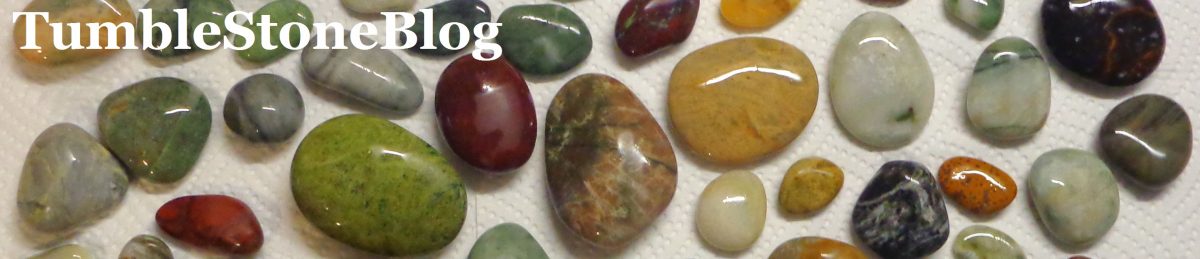
A Blog About Stone Gathering, Tumbling and Polishing, and Rocks and Landscapes, from New Zealand – With Musical Interludes (john.tumblestone@gmail.com)
One of my favourite beaches is Slapton Sands in Devon, England, a pebble beach I visited in 2016 and 2017.
Me at the south end of Slapton Sands, near a WWII gun emplacement, 2017
Petra on Slapton Sands, a pebble beach, in 2017
Stones from Slapton Sands
Stones from Slapton Sands
TumbleStone Blog has a series of Posts on this fascinating beach and its history and geography. The first Post, dated 8 September 2016, is here. One of the Posts discusses the tragedy of Exercise Tiger, a practice for D-Day, with a planned landing on Slapton Sands. Slapton Sands had a number of similarities to Utah Beach, where US soldiers were to land. On 28 April 1944, in the bay off Slapton Sands, the convoy of landing craft carrying US troops was intercepted by German E-boats. Two of the landing craft were sunk and one badly damaged, with the loss of 749 of the US servicemen. Due to the secrecy surrounding D-Day and its preparations, the disaster was kept secret and often it was decades later before relatives learned what really happened to their fathers, brothers or sons.
To commemorate the 75th anniversary of this tragedy, an installation artist, Martin Barraud, has laid 749 bootprints in the pebbles of Slapton Sands.
The installation was unveiled by the Remembered charity and will raise money for veteran employment projects. An article in the Daily Mail on 28 April 2019 provides an excellent and well-illustrated account of Barraud’s project as well as the history of “Exercise Tiger”.
Martin Barraud is in the middle of an ambitious installation project in the UK called “There But Not There”. His aim is to make visible the dead of World War One, giving them a shape and a name. As an Evening Standard article puts it, “There are ghostly Tommies in St Pancras station, in a chapel in the Tower of London, in a football stadium: either a six-foot aluminium silhouette with head bowed, or a Perspex figure you see, then somehow don’t see, sitting down.” Barraud, has given every one of them the name of a real soldier.
By November this year, the centenary of the end of the war, he hopes to have sold a figure to represent every one of the 883,246 men from Britain and Ireland who died, the funds to go to military charities.
The June page for this calendar (above, left) has a photo of Kiritehere Beach, on the west coast of the North Island, which Petra and I visited in September 2018, and some of the rocks with monotis fossils that we found there. The rocks on this beach are full of these fossils. I have not tried to tumble polish them. Budleigh Salterton features on the July page (above, right). This village in Devon has a pebble beach full of red iron-stained quartzite stones from the cliffs nearby. We have visited there when we have been in Devon in the past three years. For more detail on Budleigh Salterton and its stones, see the comments on Stone #7 in the post on Twelve Stones, Part Three.
For August, one of my favourite stones appears, banded rhyolite. Stones of this type can be found on beaches along part of the south coast of the South Island, especially around Riverton and Orepuki. The beach featured on the August page is the beach past the Back Beach at Riverton (just beyond the end of the road). September’s beach is another one in the UK that Petra and I visited in 2018, Penmon Point on the Isle of Anglesey in Wales. There I found a black stone with interesting patterned fossils in it (I have not been able to identify the fossils), and a number of limestone pebbles also with fossil shells that are much fainter.
This Post describes Stones #7 to #9 of the 12 (Part One dealt with Stones #1 to #3 and Part Two with Stones #4 to #6):
7) Stone #7 Red-Stained Quartzite, found near Budleigh Salterton, England.
On two recent visits to England, in 2017 and 2018, I went to a coastal village of about 5,000 inhabitants called Budleigh Salterton in Devon, not far from Exeter. The Doomsday Book records that salt panning was of great importance here, and it may have been as far back as Roman or even Iron Age times, hence the origin of the name “Salterton”. The beach, three miles (nearly five kilometres) in length, has a distinctive mix of stones, many deriving from the Budleigh Salterton Pebble Bed which outcrops in the cliffs there.
Looking south-west towards the village of Budleigh Salterton
Looking north-east along the beach at Budleigh Salterton
Budleigh Salterton beach huts
Beach huts and red cliffs at Budleigh Salterton
The layers of pebbles found in the cliffs at Budleigh Salterton originated over 400 million years ago when sandstones formed under desert conditions in the place in France we now call Brittany. During the Triassic period, these rocks were eroded and transported by vast rivers across what later became the English Channel to form the Budleigh Salterton Pebble Beds. The pebbles then fell onto the beach and have been transported eastwards by the sea, well beyond Budleigh Salterton.
The East Devon and Dorset Coast, known as the Jurassic Coast, has become a World Heritage Site due to the geology of the area. In 95 miles (150 kms), 185 million years of earth history are on display in the coastal cliffs. Older Triassic rocks (between 251 million and 200 million years old) give way to Jurassic rocks (200 million to 145 million years old) and younger Cretaceous rocks (145 million to 66 million years old).
Part of an Information Panel in Budleigh Salterton
Information Panel section on the pebble beds
Red pebble cliffs
Dry stones on Budleigh Salterton beach
When the stones are wet, their colours become apparent. In the middle is a stone with dark red speckles, just like Stone #7
Stone #7 is at bottom centre, just off the beach
The British geologist Ian West has a very interesting web page on Budleigh Salterton and the surrounding area (even though it can be difficult to read in places). There he states that the dominant pebbles in the Budleigh Salterton Pebble Bed are quartzite (if you go to this link, click again on it to enlarge the writing at the bottom of the photo). Quartzite is a very hard durablemetamorphic rock composed almost entirely of quartz. It forms when a quartz-rich sandstone is altered by the heat, pressure, and chemical activity of metamorphism. These conditions recrystallize the sand grains and the silica cement that binds them together. The result is a network of interlocking quartz grains of incredible strength. Impurities in Quartzite can cause it to be yellow, orange, brown, green, or blue. The presence of iron results in pink, purple or (as with Stone #7) red.
Location of Budleigh Salterton in south-west England (source: Google Maps):
8) Stone #8 White-Grey Quartzite.
I collected this stone at Birdlings Flat, Canterbury, a beach that I try to visit at least a couple of times each year because of the Quartzites, Jaspers and Agates (see Stone #11) to be found there. Birdlings Flat is the beach immediately south of Banks Peninsula, part of Kaitorete Spit, an enormous barrier gravel bank which lies between Lake Ellesmere and the sea. Stones washed down from the Alps by Canterbury rivers are swept northwards along the coast and deposited here.
Where Birdlings Flat beach meets with Banks Peninsula
Looking southwest along Birdlings Flat beach
The waves are powerful and unpredictable, especially at the Banks Peninsula end
The Birdlings Flat beach is part of the 25 km long Kaitorete Spit which consists entirely of stones
Looking for stones about eight kilometres along Kaitorete Spit
As mentioned in relation to Stone #7, Quartzite is a very hard durable metamorphic rock composed almost entirely of quartz. Many different coloured Quartzite stones can be found at Birdlings Flat, as attested by the collection to be found at the Birdlings Flat Gemstone and Fossil Museum, which I have visited a number of times.
Part of the Quartzite Collection at the Birdlings Flat Gemstone and Fossil Museum. At top right is a large white-grey stone, with a fault through it. Photos with permission
Some white-grey Quartzite stones similar to Stone #8 can be seen on the lower row
Another part of the Quartzite Collection at the Birdlings Flat Gemstone and Fossil Museum
More Quartzite stones, Birdlings Flat Gemstone and Fossil Museum
Stones in Birdlings Flat Gemstone and Fossil Museum, including Quartzites
Stone #8 is one of a number of white-grey Quartzites I have found at Birdlings Flat. The large bands of white and grey provide a striking contrast, making this stone particularly attractive.
Stones collected at Birdlings Flat, including some white-grey Quartzites
Two Quartzites from Birdlings Flat
Two good-sized tumble-polished Quartzites from Birdlings Flat
A darker white-grey Quartzite
Quartzite with more white than grey
A white-grey Quartzite found and polished by Petra
I picked up this interesting little stone at Henderson Bay, Riverton Rocks. I initially wondered if it might be a piece of petrified wood, given its pattern and texture. Some agatised wood (see photos below) that I have seen has some similar patterns. Petrified wood forms when wood is buried by sediment and protected from decay by oxygen and organisms. Groundwater rich in dissolved solids flows through the sediment, replacing the original wood material with, for example, silica, calcite, or pyrite. Agatised wood has been petrified by agate, a form of chalcedony or microcrystalline quartz. However, the agatised wood I have seen tends to be quite glassy when polished, something absent from this stone.
Agatised wood specimens at the Birdlings Flat Gemstone and Fossil Museum
Petrified wood bought at Hettie’s, Akaroa, March 2017
Hettie’s Rock and Crystal Shop, Akaroa
Another side of the same piece of petrified wood
I have also seen petrified wood at Curio Bay, about 130 kms east of Riverton.
Curio Bay, Catlins Coast, Southland
Information Plaque about Curio Bay
The steps down to Curio Bay
Looking down on Curio Bay from the top of the steps
Trunk of a petrified tree at Curio bay
Petrified wood in the rocks at Curio Bay
Petrified wood in the rocks at Curio Bay. My foot for scale
Petrified wood in the rocks at Curio Bay
On the basis of what I have seen, I am unsure whether Stone #9 is agatised wood or some other form of petrified wood, or something entirely different. I have more unidentified stones than identified ones in my collection. [Later I came to the view that this stone is much more likely to be a mix of quartz and a black mineral, not any type of petrified wood.]
I found Stone #9 at Henderson Bay, the last of the Bays that make up Riverton Rocks, the part of Riverton that is made up of holiday homes. My grandparents owned a “crib” (“bach” to North Islanders of New Zealand) at Henderson Bay, up on the hill overlooking the sea, and when I was a boy my family spent two weeks every summer on holiday there.
Henderson Bay, Riverton Rocks, September 2018 – the road continues on to the Back Beach
Henderson Bay, February 2016
Henderson Bay, looking back at the steps
Argillite rocks at Henderson Bay, stones above the high tide mark on the beach
Drift of stones, Henderson Bay
Henderson Bay stones
Henderson Bay stones
Location of Henderson Bay and Back Beach, Riverton (source: Google Maps):
Part Four is the final Post in this series, dealing with Stones #10, #11 and #12.
Malham Cove, viewed as we walked back towards Malham village
A man near the edge of the limestone pavement at the top of Malham Cove
Petra walking down towards the top of Malham Cove, towards the limestone pavement
The stunning Malham Cove is a huge curving amphitheatre-shaped cliff formation of carboniferous limestone rock with a vertical face about 80 metres (260 feet) high, with a large area of deeply eroded limestone pavement at the top. On 21 June, on Day Five of an 11 day driving trip in the UK, Petra and I visited Malham Cove while on a four hour walk in the Yorkshire Dales National Park. We started at the National Park Centre in the village of Malham, picking up a leaflet on the Malham Landscape Trail. Embarking on this seven kilometres walk, we followed a path through fields and woods, past stone walls and barns, to a waterfall called Janet’s Foss, to a dramatic canyon called Gordale Scar, and then on to Malham Cove.
Malham Cove was formed by a waterfall carrying meltwater from glaciers at the end of the last Ice Age, more than 12,000 years ago. An extraordinary amount of water was involved, scouring out this large rock ledge and face. This erosion took place more actively at the lip of the fall, hence the curved shape. Today, a small stream named Malham Beck seeps out from the bottom of the massive steep face of the cove.
Approaching the top of Malham Cove
The limestone pavement at the top of Malham Cove
Looking up at people on the skyline, walking on the limestone pavement at the top of Malham Cove
Where the Malham Beck seeps out from the bottom of the Malham Cove cliff face
Petra and Malham Beck
The route we walked took us first to a small hill leading down to the top of the Cove. It was here that we came across the “limestone pavement”, a rock platform that had been exposed by the scouring action of glaciers. Due to the mildly corrosive effects of slightly acidic rain water on the limestone, a process which also leads to the formation of caves and potholes, deep crevasses slowly developed in the rock so that the limestone pavement is actually a “mosaic” of interlocking “clints” and “grykes”. The clints are the flat blocks of limestone separated by the grykes which are deep crevices. As you walk across them, some of the clints move, proving they are sitting loosely. The grykes can be quite deep, maybe as much as a metre to a metre-and-a-half deep. The microclimate of the grykes is more humid and slightly warmer than on the pavement itself, resulting in a different range of vegetation growing in them, such as ferns, wood sorrel, dog’s mercury, and anemones.
Clints and grykes
Petra standing on a clint
Petra looking out towards Malham Village from the top of the Cove
A pigeon looking at Petra taking its picture
Vegetation in the grykes, the result of their micro-climate
Information panel at the top of Malham Cove
The limestone pavement at the top of Malham Cove – spot Petra top centre
Youtube clip of Malham Cove from a drone camera:
Malham’s limestone pavement was used as a location for the 1992 film version of Emily Brontë’s “Wuthering Heights”. It was also featured in “Harry Potter and the Deathly Hallows (Part 1)” as one of the places Hermione and Harry visit.
When Petra and I arrived at the top of Malham Cove, a number of people were intently gazing at a small tree along the face of the side of the Cove. It turned out they were looking at peregrine falcons. Some of these impressive birds of prey have nested at Malham Cove since 1993. At the bottom of the Cove, we came across a viewpoint run by the Royal Society for the Protection of Birds and the Yorkshire Dales National Park Authority. They had set up telescopes for people to look at the peregrines. This year’s chicks had recently fledged.
Peregrine falcon on the side of Malham Cove.
Peregrine falcon viewpoint point at Malham Cove.
Also at the bottom of the Cove, when we walked up to the source of the the stream that runs from its base, we spotted a couple of climbers practicing their moves. Malham Cove is a popular climbing spot and offers significant challenges.
This is an amazing landscape feature, carved out of limestone by ice and water. It is difficult to do it justice.
Youtube clip of the peregrine watch at Malham Cove:
In 2003 I had visited Stonehenge while on a camper-van holiday in the UK. I found it intriguing and mysterious. I also visited the much larger and quite different stone circle at Avebury, a few kilometres to the north, and was again struck by its ancient mystery. Since then, I have read a lot about stone circles, megaliths and standing stones, feeling drawn to them. I read about the Standing Stones of Callanish (sometimes referred to as the “Calanais” Stones) on the Isle of Lewis in northern Scotland and they seemed to me to be among the most interesting and intriguing, and about twelve years ago I bought a photo of them to hang in my hallway at home.
On Friday 27 May 2017 I flew into Stornoway, the main town on the Isle of Lewis in the Outer Hebrides. I was on my way to spend a few weeks with my wife who was working with dairy farmers in Devon, and I took the opportunity to visit Lewis for three days with the main aim of seeing the Standing Stones of Callanish firsthand. The following morning, I met with Dave Godwin, a local archaeologist, who I had hired for the day to show me around the Island and to fill me in on its history, culture and environment. Later that afternoon he introduced me to the Callanish Stones.
That evening, and the next couple of nights, I stayed with John Angus Morrison at Taigh Solus, an excellent B and B accommodation in the village of Arnol. John was a very good host and looked after me well, and we had some great conversations about life, the universe and everything. I returned to the Stones the next two days and also spent time at other megalithic sites nearby. I took photos from an array of different distances and angles. The weather was cold and partly-cloudy, and at times there were up to 15 people visiting – Callanish is easily accessible, anyone being able to walk among the Stones and touch them.
These Standing Stones pre-date Stonehenge by about 500 years, having been erected about 5,000 years ago. They were an important place for ritual activity for at least 2,000 years. It is generally believed that Callanish functioned as an astronomical calendar associated with the moon and that it accurately marked the 18.61 year cycle of maximum lunar declination. Every 18.61 years, the moon skims especially low over the southern hills on the horizon, skimming the tops of the Stones.
There are about 50 stones at the main site at Callanish. Thirteen of them (with an average height of three metres) are set in a circle of just over 11 metres in diameter, with a five-metre high monolith, probably weighing about seven tonnes, near the middle (see aerial photo below). Five rows of standing stones connect to this circle – two long rows of stones (nine on one side and ten on the other) run almost parallel to each other for about 80 metres from the stone circle to the north-northeast, forming a kind of avenue; shorter rows of stones run to the west-southwest, south and east-northeast. These stones are between about two-and-a-half and three-and-a-half metres high. Within the stone circle is a chambered tomb in front of the central stone.
It is argued by many that the Standing Stones are a complex and sophisticated celestial observatory, many aspects of which are now lost to us. How the Stones are aligned, their shapes, their heights, the shadows they throw, how they relate to the sun and moon and stars, and how they relate to the surrounding landscape, are thought to be significant. One scholarly study showing Callanish was constructed specifically in line with the movements of the sun and moon, 5,000 years ago, is Gail Higginbottom and Roger Clay (2016), “Origins of standing stone astronomy in Britain: New quantitative techniques for the study of archaeoastronomy”. These researchers also discovered a complex relationship between the alignment of the stones, the surrounding landscape and horizon. A University of Adelaide press release quotes Dr Higginbottom: “This research is finally proof that the ancient Britons connected the Earth to the sky with their earliest standing stones, and that this practice continued in the same way for 2,000 years.” Examining a number of standing stone sites in detail, it was found that about half the sites were surrounded by one landscape pattern and the other half by the complete reverse. “These chosen surroundings would have influencedthe way the sun and moon were seen, particularly in the timing of their rising and setting at special times, like when the moon appears at its most northerly position on the horizon, which only happens every 18.6 years,” Dr Higginbottom stated. “For example, at 50% of the sites, the northern horizon is relatively higher and closer than the southern and the summer solstice Sun rises out of the highest peak in the north. At the other 50% of sites, the southern horizon is higher and closer than the northern, with the winter solstice Sun rising out of these highest horizons. These people chose to erect these great stones very precisely within the landscape and in relation to the astronomy they knew. They invested a tremendous amount of effort and work to do so. It tells us about their strong connection with their environment, and how important it must have been to them, for their culture and for their culture’s survival.”
A small demonstration of one aspect of how the summer solstice is recorded on the Callanish Stones is on YouTube:
The stones are local Lewisian gneiss, the oldest rock in the British Isles. This rock is igneous in origin but has been subject to significant metamorphic forces. White quartz and dark hornblende crystals can be seen in the stones. The word “gneiss” (pronounced “nice”) comes from the Middle High German verb “gneist”, meaning “to sparkle”, as the rock glitters.
Gneiss is an ancient and very hard rock. It is medium to coarse grained. It has been subject to high pressure and heat, so much so that the minerals in it separate out and form distinct but often discontinuous bands. Light-coloured bands are mainly formed of quartz and feldspar while the darker bands consist of minerals like amphibole (hornblende), pyroxene and biotite mica. Unlike slate and schist, gneiss does not preferentially break along planes of foliation because less than 50% of the minerals formed during the metamorphism are aligned in thin layers. It is because of the coarseness of the foliation that the layers do not have a constant thickness, and are discontinuous.
Gneisses form deep in the Earth in subduction zones or under the roots of fold mountains. They are bought to the surface only by massive tectonic movements or slow erosion. Gneiss from western Greenland comprises the oldest crustal rocks known (more than 3.5 billion years old, about two-thirds the age of the Earth). Lewisian gneiss is about three billion years old, the oldest rocks to be found in Britain. It is thought that the original rock was probably sandstones and limestone or igneous rocks like basalt and granite, which was then subject to metamorphism. About two million years ago the Ice Age came to Lewis. The movement then retreat of large glaciers formed the smooth rocky landscape of Lewis. After the main ice melt 12,000 years ago, the sea level rose, flooding river valleys and lower ground and creating the lochs and drowned valleys of the Isle. As the climate improved, soil formed and plants and woodland returned. Peat developed on the poorly drained ground and extended upwards and outwards to cover large tracts of land.
The Callanish Stones are thought to have been quarried about one to two kilometres from their present site. They are very good examples of Lewisian gneiss.
Useful Sources on the Standing Stones of Callanish:
“Callanish” in “Odyssey: Adventures in Archaeology” website.
The 59 stones from Slapton Sands were put through the usual five-week cycle of tumble smoothing and polishing – one week each of tumbling with 100 grit, then 220 grit, then 320 grit, then a tin oxide pre-polish, then a tin oxide pro-polish:
Comparing some of the polished stones with what they looked like “in the rough”:
In his 1954 book, “The Pebbles on the Beach”, Clarence Ellis has a chapter on “The Coastline of England and Wales”. There he writes (page 125):
In the middle of Start Bay is a bed of shingle that must not be missed. This is the extensive bar at Torcross that encloses the lagoon called Slapton Ley. There is one very unusual feature about it. Its pebbles do not come from the rocks of the Bay. Many of them are flints, yet there is no chalk or other flint-bearing rock near to Torcross. The other pebbles are quartz, including very small ones that are pear-shaped, and granite from Dartmoor.
The website of the Slapton Ley National Nature Reserve has some good information on the bar, its beach and its stones. This Reserve is managed by the Field Studies Council in partnership with the owners. Whitley Wildlife Conservation Trust, along with Natural England and South Hams District Council. Their website highlights the significance of “longshore drift” which is when waves hit the shore at an angle and will move stones and sediment in a certain direction along a stretch of coastline. The website continues: [Note: August 2019 – The website has recently been changed and no longer contains this information]
Slate is the bedrock of Start Bay and so is found in the cliffs bordering the beach. It is a metamorphic rock, changed from clays by heat and pressure, but is relatively soft and so erodes easily. You may find large pieces of slate near the cliffs that have recently been eroded but because it breaks down quickly it is hard to spot much slate on the centre of the ridge. Schist is a very resistant metamorphic rock, and forms Start Point headland jutting out to sea at the south end of Start Bay. It was formed in the Devonian around 395 million years ago. The schist and some of the slate has seams of quartz running through it. Quartz is the most abundant mineral in the Earth’s crust and you will be able to find plenty of it on the ridge. It is a milky white. You can find some igneous rock on the beach, most transported by rivers that have their source on Dartmoor. Quartzite is pinkish and forms a very smooth pebble. It can be found just offshore and was transported up onto the beach by rising sea levels. Most of the shingle making up the ridge is flint; it makes up about 80% of the material on the beach. Flint is only found about 30-40km offshore from the present day coastline which suggests that Slapton Sands originates from this area.
During the visit to Slapton Sands in mid-2016, a few handfuls of stones were collected (59 individual stones in all). Some jasper and quartz are apparent. The photos below are of dry stones followed by some photos of them wet, hinting at how they might look when polished.